Riverscapes Viewers
The Riverscapes Viewers make it possible to consume and explore any of the riverscape projects available on the Data Exchange.
- A free way to view riverscape data with curated symbology - Easily explore riverscape projects as maps, with repeatable, curated symbology and meaningful layer organization.
- Consistent Cartography - Stop wasting time repeatedly symbolizing layers. Riverscapes Viewers automatically applies carefully curated symbology to data, ensuring the same look and feel every time.
- Logical Table of Contents - Data are presented in a meaningful hierarchy that is relevant to the type of data you are looking at. Layers can be added to your current map and are automatically organized into a matching table of contents.
- Helpful Metadata - Riverscapes Viewers make it easy to see where data originated from and navigate to the source. Metadata is available for all layers, providing context and provenance.
Versions
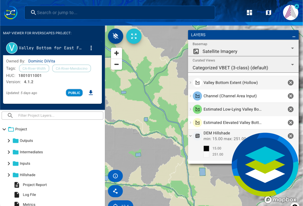
Web Viewer
Explore riverscape projects in your web browser. No installation required.
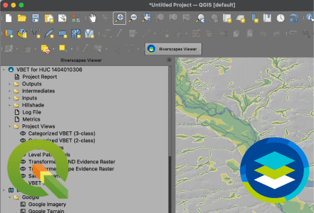
QGIS
A free plugin for QGIS.
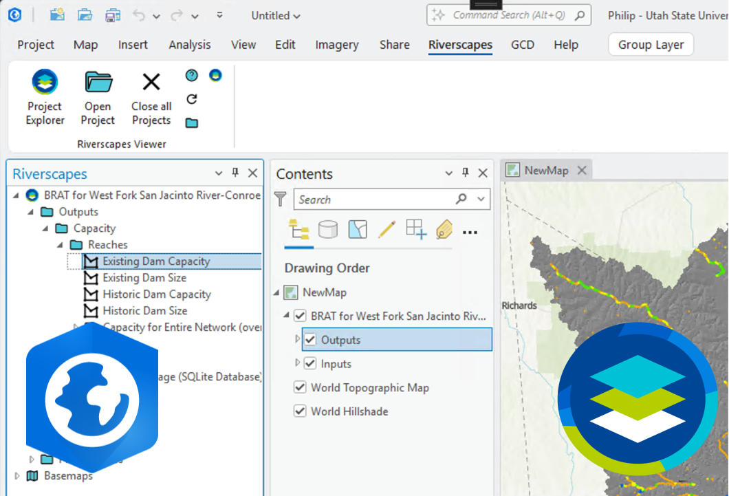
ArcGIS Pro
A free add-in for ArcGIS Pro.
Other Riverscapes Sites
Riverscapes Consortium
The main site for the Riverscapes Consortium.
Riverscapes Data Exchange
A public platform for discovering, sharing, and downloading Riverscapes compliant data.
Viewer Knowledge Base
A collection of articles related to the Riverscapes Viewers.